We use cookies to distinguish you from other users and to provide you with a better experience on our websites. Close this message to accept cookies or find out how to manage your cookie settings.
To save content items to your account,
please confirm that you agree to abide by our usage policies.
If this is the first time you use this feature, you will be asked to authorise Cambridge Core to connect with your account.
Find out more about saving content to .
To save content items to your Kindle, first ensure [email protected]
is added to your Approved Personal Document E-mail List under your Personal Document Settings
on the Manage Your Content and Devices page of your Amazon account. Then enter the ‘name’ part
of your Kindle email address below.
Find out more about saving to your Kindle.
Note you can select to save to either the @free.kindle.com or @kindle.com variations.
‘@free.kindle.com’ emails are free but can only be saved to your device when it is connected to wi-fi.
‘@kindle.com’ emails can be delivered even when you are not connected to wi-fi, but note that service fees apply.
Farming has modified the natural dynamic of soil erosion/redistribution in significant parts of landscapes, triggering high rates of soil loss and accelerating sediment connectivity. This chapter provides a review of sediment connectivity in grassland, herbaceous and woody crops from knowledge to management. The first section explores the extension of farmland at a global scale and the process of agricultural land expansion. Regarding herbaceous crops, the second section highlights the importance of cropping intensity (one or two crops per year), water supply (rainfed or irrigated), and crop rotation on the sediment-connectivity magnitude. In the section of woody crops, studies done in vineyards, olive groves and citrus orchards describe the processes of sediment connectivity with and without soil conservation practices (e.g., cover crops). The section of sediment connectivity in grasslands includes examples in alpine hillsides, valley bottom and lakes, emphasizing their role as sediment-trapping features. The last section deals with sediment dis-connectivity in farmland due to soil erosion control practices and governmental programs, with examples from Europe and China.
Because soil erosion constrains agricultural productivity and overuse of soils exacerbates erosion, land use can only be sustained through the implementation of land evaluation. We studied five land-use scenarios including erosion-reducing land terracing and contour farming using ILSEN modelling. These scenarios’ rates of soil loss were determined using the revised universal soil loss equation (RUSLE) method. We found that all the erosion-reducing scenarios reduced soil loss compared to the current land use of the study area; in the non-agricultural land use, soil erosion was reduced 4.25 times. The model is expected to inform reduction of soil erosion in geographies characterized by rugged topography.
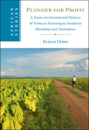
The critical importance of tobacco to the Zimbabwean economy is reflected by the profoundly flattering epithets deployed over the years to describe the crop: ‘leaf of gold’, ‘most promising weed’, ‘crucible’, ‘lifeblood’, ‘golden lining’. Tobacco is situated at the nerve centre of the body politic, central to the country’s political economy. Zimbabwe is the largest producer of tobacco in Africa, and the fifth largest producer of flue-cured tobacco in the world after China, Brazil, India and the United States.
This chapter discusses the impact of the 1966 tobacco embargo and the war of liberation, 1972–1980 on tobacco farming landscapes in Southern Rhodesia. It integrates the political and economic aspects of the Unilateral Declaration of Independence of 1965 into ecological narratives towards understanding how the pressures of economic sanctions and war prompted new patterns of agrarian development and conservation practices in tobacco farms that had an impact on the environment and landscapes.
Exploring over a century of Zimbabwe's colonial and post-colonial history, Elijah Doro investigates the murky and noxious history of that powerful crop: tobacco. In a compelling narrative that debunks previous histories glorifying tobacco farming, Doro reveals the indelible marks that tobacco left on landscapes, communities, and people. Demonstrating that the history of tobacco farming is inseparable from that of colonial encounter, Doro outlines how tobacco became an institutionalised culture of production, which was linked to state power and natural ecosystems, and driven by a pernicious heritage of unbridled plunder. With the destruction of landscapes, the negative impacts of the export trade and the growing tobacco epidemic in Zimbabwe, tobacco farming has a long and varied legacy in southern African and across the world. Connecting the local to the global, and the environmental to the social, this book illuminates our understandings of environmental history, colonialism and sustainability.
Radiocarbon (14C) dating of the total organic carbon (TOC) content of lacustrine sediments is always affected by a 14C reservoir effect and the 14C dates are often systematically older than the true ages. However, there are few studies of the temporal changes of the 14C reservoir effect, with reference to the specific influencing factors. We collected TOC samples from the Holocene sediments of Lake Kanas, in the southern Altai Mountains, for AMS 14C dating and compared the results with AMS 14C ages based on terrestrial plant macrofossils from the same depths. The results show that the reservoir ages progressively increased from ∼0 to ∼2800 yr between ∼9700 cal BP and ∼530 cal BP. As the lake catchment was glaciated prior to the Holocene, and Holocene soils and peats are the main sources of the TOC in the lake sediments, we argue that soil erosion is the major factor contributing to the progressive increase in the reservoir age. Based on previously reported evidence for increasing moisture in central Asia and glacier advances in the mid-to-late Holocene, we suggest that the intensified soil erosion on the hillslopes was caused by increased precipitation during the mid-to-late Holocene and by anthropogenic forest clearance after 1500 cal BP.
This essay explores the intersecting socio-material and ethical demands that engineers confront in adapting sea defenses to climate change in Guyana. It focuses on the tensions in climate adaptation that create the possibilities for theorizing innovation as a key theme of counter-modernities in the Anthropocene. Drawing on ethnographic fieldwork, oral histories, and archival research, I show that engineers’ decision-making regarding whether or not to innovate sea defenses is a fraught process dependent upon processes of erosion and the ontological (in)stability of specific infrastructures known as groynes. To cope, engineers produce what I call “innovation narratives” to describe how obstacles to climate adaptation are created by combinations of neocolonial empire, shapeshifting ecologies, inconsistent maintenance programs, and fiscal debt. At the same time, their efforts signal an emerging global politics of credibility that is reinforced by desires for more inclusive forms of governance rather than brute power or capitalization.
Water erosion is one of most important global environmental problems which has been widely researched but remains poorly understood because of the complexity of its underlying mechanisms driven by interacting environmental factors. Water erosion is highly sensitive to climate change and associated events such as increasing extreme rainfall events and global warming. This chapter provides a comprehensive overview of the research progress on water erosion processes, as well as how they can be influenced by the natural and anthropogenic factors. The main water erosion control practices are introduced, which need better spatial and temporal allocations under future climate risk. We also reviewed the literature that has quantified direct and indirect climate change impacts on water erosion. Future avenues of research might include: deeper investigation of the natural and anthropogenic factors associated with water erosion, high resolution predictions of water erosion at larger scale and evaluation of economic models associated with erosion control practices to help policymakers develop and implement measures to mitigate the impacts of climate change.
This research explains what happened to agricultural soil fertility during the “Campanha do Trigo” (Wheat Campaign) in Portugal, which began in 1929. It is commonly understood that the excessive expansion of wheat crops during the fascist “Estado Novo” (New State) regime led to the degradation of soils in the southern half of Portugal. This relationship, however, has never been questioned before. This article extends the narrative back into the last half of the nineteenth century in search of the origin of processes that gradually intensified throughout the country. In short, expansion of the cultivated area in association with the inadequate intensification of crop rotations over about 80 years, from the 1870s onward, including in non-wheat areas, strongly accentuated soil erosion and made organic fertilization progressively less effective. These transformations were only partially offset by chemical fertilization. Nitrogen and phosphorus were the key factors in this historical process. Focusing on the cultivation system and soil dynamics allows the successive integration of various kinds of historical evidence and sources. From an environmental question—why did agricultural soil degrade?—this article explores soil degradation over time and space, and assesses its social and biophysical impacts. At the same time, it addresses the history of agriculture in Portugal and its disciplinary foundations.
Chapter 9 is devoted to one of the most important new developments in soil research in the last 50 years: the linkage of geomorphological models with soils on hillslopes. Soils on hillslopes are dynamic entities that are constantly in motion and that exhibit aspects of complex systems, with feedbacks that stabilize them and help ensure their presence on all but the more extreme conditions on Earth. The processes (and models) to describe hillslope mass balance (erosion and production) are introduced. The importance of hillslope erosion and soil production to biogeochemistry is considered. Finally, soils on depositional landforms, which receive the material from the hillslopes, are also considered.
Under Prime Minister J. B. M. Hertzog (1924–1939), the state became increasingly central to scientific research and industrialisation. Hendrik van der Bijl and H. J. Van Eck developed national power supply through the state electricity commission (Escom) and used the Industrial Development Council to fund state-led enterprises. State officials and scientists devoted themselves to environmental issues from soil erosion to irrigation, invasive plants and vermin eradication. With Jan Smuts back in power in the war years, competing ‘worlds of possibilities’ emerged in political and scientific imaginations: Anglophone and liberal constituencies looked forward to reforms and postwar reconstruction; the African National Congress focussed on social progress, welfare and human rights for all; Afrikaner nationalists began to envisage an alternative utopia of republican independence and apartheid. The promise of science in helping to deliver these outcomes was expressed by all three political traditions. Improved economic prospects, fuelled by the expansion of gold mining, encouraged urbanisation, state planning, industrial development and social welfare. Science became an arm of an increasingly interventionist state, planning for national postwar reconstruction that envisaged less rigid racial divisions and promised conservation and development in African areas.
Soil and nutrients losses due to soil erosion are detrimental to crop production, especially in the hilly terrains. An experiment was carried out in three consecutive cropping seasons (2012–2015) with four treatments: sole maize; sole maize with plastic mulch; maize and cowpea under plastic mulching; and maize and soybean under plastic mulching in randomized block design (RBD) to assess their impact on productivity, profitability, and resource (rainwater, soil, and NPK nutrients) conservation in the Indian sub-Himalayan region. The plot size was 9 × 8.1 m with 2% slope, and runoff and soil loss were measured using a multi-slot devisor. The results showed that mean runoff decreased from 356 mm in sole maize with plastic mulch plots to 229 mm in maize + cowpea intercropping with plastic mulch, representing a reduction of 36% and corresponding soil loss reduction was 41% (from 9.4 to 5.5 t ha−1). The eroded soil exported a considerable amount of nitrogen (N) (13.2–31.4 kg ha−1), phosphorous (P) (0.5–1.7 kg ha−1), and potassium (K) (9.9–15.6 kg ha−1) and was consistently lower in maize + cowpea intercropping. The maize equivalent yield (MEY) was significantly higher in maize + cowpea with plastic mulch intercropping than the other treatments. These results justify the need to adopt maize with alternate legume intercrops and plastic mulch. This strategy must be done in a way guaranteeing high yield stability to the smallholder farmers of the Indian sub-Himalayan region.
To tackle the problem of soil erosion and moisture stress, the government of Ethiopia introduced a yearly mass campaign where communities get together and implement various soil and water conservation (SWC) and water harvesting (WH) practices. Although the interventions are believed to have reduced soil erosion/sediment yield and enhanced surface and ground water, quantitative information on the impacts of various options at different scales is scarce. The objective of this study was to assess the impacts different land uses, SWC and WH interventions on water and suspended sediment yield (SSY) at plot and watershed scales in the central highlands of Ethiopia. Standard erosion plot experiments and hydrological stations were used to monitor the daily water and SSY during 2014 to 2017. The results show differences between treatments both at plot and watershed scales. Runoff and soil loss were reduced by an average 27 and 37%, respectively due to SWC practices at the plot level. Overall, SWC practices implemented at the watershed level reduced sediment yield by about 74% (in the year 2014), although the magnitude of sediment reduction due to the SWC interventions reduced over time. At both scales it was observed that as the number of years since SWC measures have been in place increased, their effectiveness declined due to the lack of maintenance. This study also revealed that extrapolating of plot data to watershed scale causes over or under estimation of net erosion.
Food, land and water as triggers for future wars. Resource scarcity: decline in availability of water and soil for food production and risk of conflict. Food demand rising while resource base shrinks. Climate change as a threat multiplier. Warning of future global food crises. Emerging global food-war cycle.
Soil conservation on the Loess Plateau is important not only for local residents but also for reducing sediment downstream in the Yellow River. In this paper, we report a decrease in soil erosion from 2000 to 2010 as a result of the ‘Grain for Green' (GFG) Project. By using the Revised Universal Soil Loss Equation and data on land cover, climate and sediment yield, we found that soil erosion decreased from 6579.55tkm–2yr–1 in 2000 to 1986.66tkm–2yr–1 in 2010. During this period, there was a major land cover change from farmland to grassland in response to the GFG. The area of low vegetation coverage with severe erosion decreased dramatically, whereas the area of high vegetation coverage with slight erosion increased. Our study demonstrates that the reduction in soil erosion on the Loess Plateau contributed to the decrease in the sediment concentration in the Yellow River.
Soil erosion can pose a serious problem to environmental quality and sustainable development. On the Tibetan Plateau, soil erosion is one of the main challenges to regional ecological security. Our analysis investigates soil erosion and evaluates its economic value in alpine steppe, alpine meadow, alpine desert steppe and forest ecosystems on the Tibetan Plateau. Analysis was carried out from 1984 to 2013. The results show that the annual average potential soil erosion, practical soil erosion and soil conservation calculated by the Revised University Soil Loss Equation model were 2.19×10⁹ta–1, 2.16×10⁹ta–1 and 2.72×10⁷ta–1, respectively. The economic value of retaining soil nutrients, reducing the formation of wasteland and the economic benefit of reducing sediment deposition were 1.98×10⁸RMBa–1, 2.55×10¹²RMBa–1 and 7.44×10⁴RMBa–1, respectively. From comparing different ecosystems, we found that the forest ecosystem had the greatest soil retention and economic values. We also found that the potential and actual soil erosion values were extremely high on the Tibetan Plateau. The study highlights that state and local policymakers must give greater emphasis to ecological protection in the future.
Given that reservoirs contain most of the leached materials from soils, we have
studied the sediments accumulated in the bottom of two groups of reservoirs developed under different climatic conditions and thus with contrasting rates of weathering/erosion regimes. Through detailed comparative study of clay minerals of the parent rocks and soils with the clay fractions of the dam sediments, we have concluded that, during cycles of erosion-transport-deposition, the leached materials have complex transformation mechanisms, making them much more active in the environment. All clay-mineral groups are well represented in the reservoir sediments, including abundant mixed-layer and partly disordered minerals. Moreover, the sediments are nutrient-rich and potentially useful as agricultural fertilizers and hence in reversing the declining soil productivity in some regions.
A 9-yr large-scale integrated pest management (IPM) study was initiated in 1985 to develop and refine profitable conservation cropping systems in the Palouse wheat-growing region of the Pacific Northwest. Weed scientists from the USDA-ARS and the land-grant universities of ID and WA led a team of researchers and extension personnel from eight disciplines to investigate the interactions of crop systems, tillage systems, and weed management levels (WML) on crop production. Ineffective weed control has been a major deterrent to the adoption of conservation tillage by wheat growers. With this in mind, the primary focus of the scientists on the IPM project was integrated weed management (IWM) in conservation crop production systems for highly erodible land. For the first time in the Pacific Northwest, systems research developed a conservation production system using a 3-yr crop rotation that controlled weeds effectively, reduced erosion, was less risky than traditional farming systems, and was profitable. Broadleaf weeds were more prevalent in the 3-yr rotation of winter wheat-spring barley-spring pea compared to continuous wheat in both conservation and conventional tillage systems. In conservation tillage, troublesome grass weeds included wild oat and downy brome. Wild oat was controlled effectively at the moderate and maximum weed management levels under conservation tillage in the 3-yr rotation. Two years out of winter wheat (such as in the 3-yr rotation) reduced downy brome populations. In contrast, growing a spring crop 1 yr, followed by 2 yr of winter wheat was not effective for controlling downy brome. Effective weed control was instrumental in developing successful conservation IPM cropping systems, and education and technology transfer were important in helping action agencies assist growers in adopting these systems.
Measurements of 137Cs concentration in soils were made in a representative catchment to quantify erosion rates and identify the main factors involved in the erosion in the source region of the Yellow River in the Tibetan Plateau. In order to estimate erosion rates in terms of the main factors affecting soil loss, samples were collected taking into account the slope and vegetation cover along six selected transects within the Dari County catchment. The reference inventory for the area was established at a stable, well-preserved, site of small thickness (value of 2324 Bq·m− 2). All the sampling sites had been eroded and 137Cs inventories varied widely in the topsoil (14.87–25.56 Bq·kg− 1). The effective soil loss values were also highly variable (11.03–28.35 t·km− 1·yr− 1) in line with the vegetation cover change. The radiometric approach was useful in quantifying soil erosion rates and examining patterns of soil movement.
High-resolution paleoenvironmental data from a peat profile with a small pollen source area are used to reconstruct the impacts oflandnámon vegetation and soils at a Norse farm complex (∅2 at Tasiusaq) comprising two farms in the Eastern Settlement of Greenland. Analyses include the AMS14C dating of plant macrofossil samples and the use of Bayesian radiocarbon calibration to construct improved age–depth models for Norse cultural horizons. The onset of a regionallandnámmay be indicated by the clearance ofBetula pubescenswoodland immediately prior to local settlement. The latter is dated to AD 950–1020 (2σ) and is characterised by possible burning ofBetula glandulosascrub to provide grassland pasture for domestic stock. Clearance and grazing resulted in accelerated levels of soil erosion at a westerly farm. This was followed by an easterly migration of settlement and agriculture. Site constraints prevent an assessment of the demise of the easterly farm, but pressures of overgrazing and land degradation may have been the major factors responsible for the abandonment of the earlier farm.